Defensible Space & Wildfire Defense in Mentone, CA
Protect your Mentone home at the foot of the San Bernardino National Forest. Connect with vetted local contractors specializing in defensible space, brush clearing, and Zone 0 compliance.
Get your free property assessment
Free • No obligation • Vetted local contractors
Local Insight
Why are Mentone homes at high wildfire risk?
Last updated: May 8, 2026
Regulatory information on this page is provided for general guidance and may not reflect the most current requirements. Always verify specific deadlines, fees, and compliance procedures with CAL FIRE (fire.ca.gov), San Bernardino County Fire Protection District, or your local fire authority before making compliance decisions.
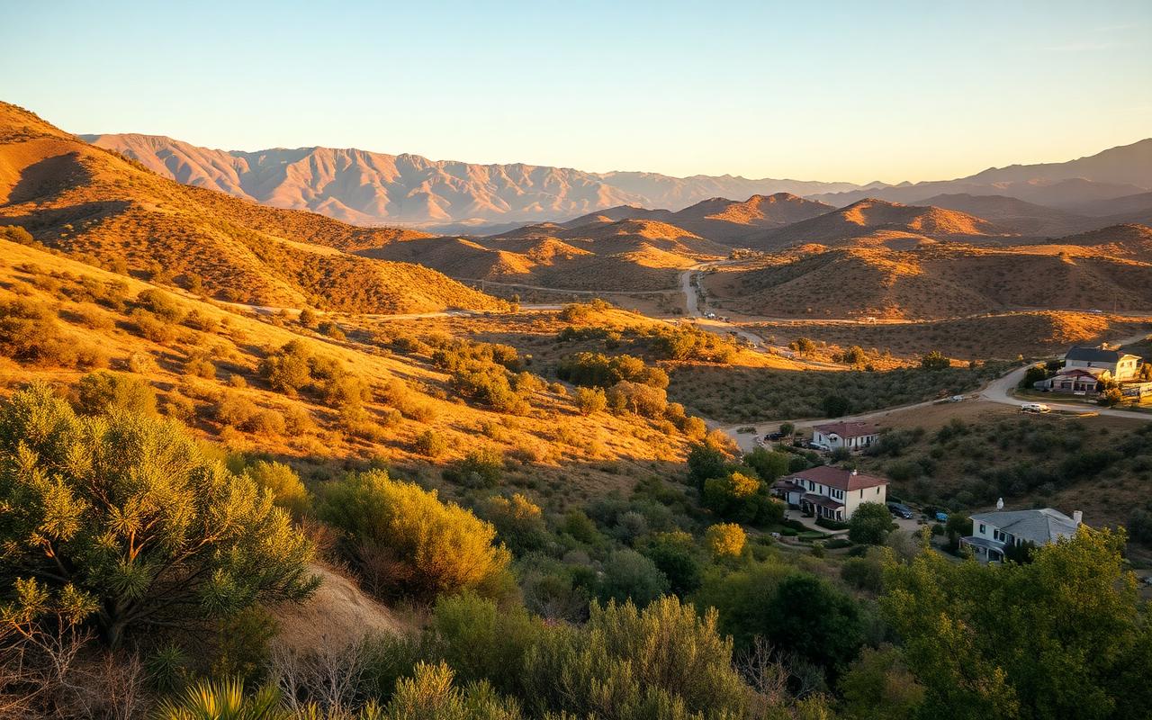
Mentone sits directly at the base of the San Bernardino Mountains, with the National Forest immediately to the north and the mouth of Mill Creek Canyon funneling Santa Ana winds straight through the community. Almost every parcel is inside a Very High Fire Hazard Severity Zone (VHFHSZ), surrounded by steep terrain, dense chaparral, and limited evacuation routes — a textbook wildland-urban interface with extreme ember exposure.
Mentone falls under San Bernardino County Fire Hazard Abatement enforcement (County Code 23.0301–23.0319), with annual inspections and 30-day compliance windows. Major California carriers have pulled back from foothill communities like Mentone, so documented defensible space work is now essential to keep — or restore — homeowners coverage.
Read the full Mentone wildfire history & local code breakdown →
Coverage
What Mentone neighborhoods do you serve?
Vetted contractors serve every Mentone neighborhood and surrounding zip codes (92359 and beyond), including:
- Mill Creek Canyon area
- Greenspot
- Crafton Hills border
- Yucaipa border
- Highway 38 corridor
- Garnet Avenue area
- Wabash Avenue area
- Opal Avenue area
See full Mentone service area & all San Bernardino County coverage →
Services
What wildfire defense services are available in Mentone?
Connect with vetted California-licensed contractors who understand Mentone's mountain-canyon terrain, dense chaparral, and Forest Falls–corridor fire behavior. Documentation suitable for CAL FIRE, San Bernardino County, and California insurance carriers.

Defensible Space Clearing in Mentone
Full PRC 4291 100-foot clearing for Mentone foothill parcels. Vetted crews handle steep slope work above Mill Creek Canyon and the Highway 38 corridor and document every zone for County and CAL FIRE inspection.
Learn more →
Zone 0 Compliance in Mentone
Zone 0 retrofits for Mentone homes ahead of AB 3074 enforcement. Combustible mulch, fencing, and plantings within 5 feet of structures replaced with hardscape and ember-resistant materials suited to canyon-wind exposure.
Learn more →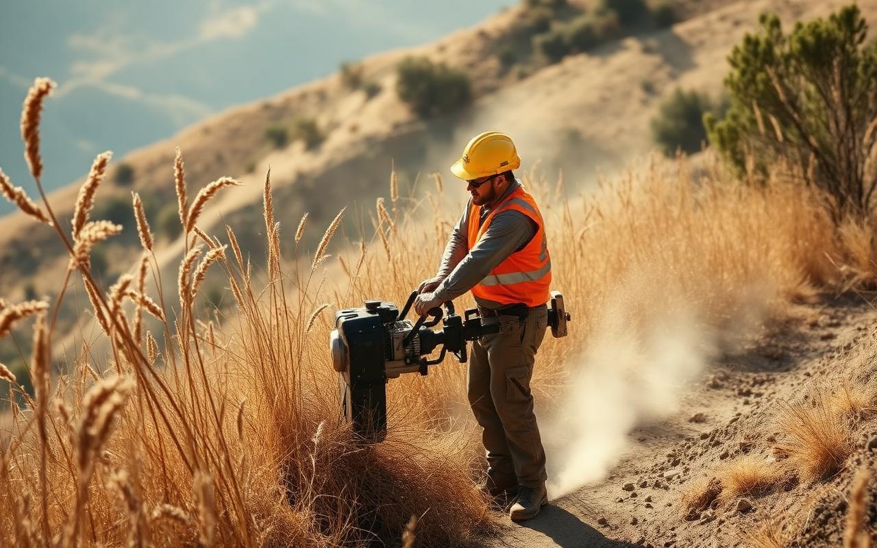
Brush Clearing & Weed Abatement in Mentone
Annual weed and brush abatement aligned with San Bernardino County's spring 30-day notice cycle. Removal of chaparral, dead fuel, and downcanyon-blown debris with written photo documentation for your file.
Learn more →
Fire-Resistant Landscaping in Mentone
Drought-tolerant, fire-resistant plant palettes and ember-resistant hardscape designed for Mentone's hot, dry summers and Santa Ana exposure at the canyon mouth.
Learn more →
Property Fire Assessment in Mentone
On-site wildfire risk assessment documenting compliance gaps against CAL FIRE, San Bernardino County Code 23.0301–23.0319, and carrier-specific insurance criteria — written reports suitable for renewal or sale.
Learn more →
Tree Thinning & Limbing in Mentone
Selective oak, sycamore, and pine work for Mentone properties — ladder fuel removal, crown spacing, and dead-tree takedowns sized for narrow canyon access roads.
Learn more →
Annual Maintenance Programs in Mentone
Pre-scheduled annual maintenance built around Mentone's County abatement cycle. Vetted contractors handle the work and the paperwork year after year — generally the most cost-effective path to staying compliant.
Learn more →FAQ
Mentone wildfire defense questions
Yes. Most of Mentone is officially designated within California's Very High Fire Hazard Severity Zones (VHFHSZ) due to its position at the base of the San Bernardino National Forest and dense chaparral terrain. Use CAL FIRE's online map at egis.fire.ca.gov to confirm your specific parcel.
Per County Code 23.0301–23.0319, Mentone properties must maintain 100 feet of defensible space around all structures, clear weeds and grasses to 4 inches or less, remove combustible debris, and properly space vegetation. Annual inspections and 30-day compliance windows apply.
Mentone's position at the mouth of Mill Creek Canyon creates a wind-funnel effect during Santa Ana events. Dense chaparral on surrounding slopes acts as ladder fuel, and the limited evacuation routes through the canyon mean fires can move faster than residents can respond.
San Bernardino County will hire a commercial contractor to clear your property at premium rates billed back to you, plus administrative fees and potential liens against the property. The cheapest path is always handling it within the 30-day compliance window.
Carriers treat the Mentone–Forest Falls corridor as an elevated risk zone. Many require documented defensible space work for renewal, and some have stopped writing new policies entirely in this area. Documented mitigation is increasingly required to maintain coverage.
Yes. Vetted contractors serve all Mentone areas including Mill Creek Canyon, Greenspot, Highway 38 corridor, and the Crafton Hills and Yucaipa border areas. Zip code 92359 and surrounding.
Related Guides
Resources for Mentone homeowners
Protect Your Mentone Home Today
Free on-site estimates for Mentone homeowners from vetted local contractors. Pass your inspection, keep your insurance, and defend your home before the next fire season.